A rare winter storm warning has been issued for the Sierra Nevada as a powerful late-season storm approaches. This blizzard threatens major highway closures and significant travel disruptions.
As of early Tuesday, snowfall totals are expected to reach 1 to 2 feet at elevations above 6,000 feet. The highest peaks could see up to 4 feet of snow. Wind gusts may reach between 50 to 70 mph, with exposed areas potentially experiencing gusts up to 80 mph.
Interstate 80 over Donner Pass is highly vulnerable to closures due to these extreme conditions. Travel advisories have been issued, urging residents and travelers to postpone non-essential travel until at least Tuesday.
In addition, a winter storm watch has been announced for specific mountain regions of Wyoming. Heavy snow is anticipated there as well, with forecasts predicting between 4 to 10 inches and up to 16 inches above 9,000 feet.
The storm is expected to move eastward into Nevada, Colorado, and New Mexico after impacting California. Winter weather can occur even in May, highlighting the unpredictability of mountainous regions.
Officials advise those who must travel during the storm to prepare by keeping emergency supplies in their vehicles. This includes items like blankets, food, and water.
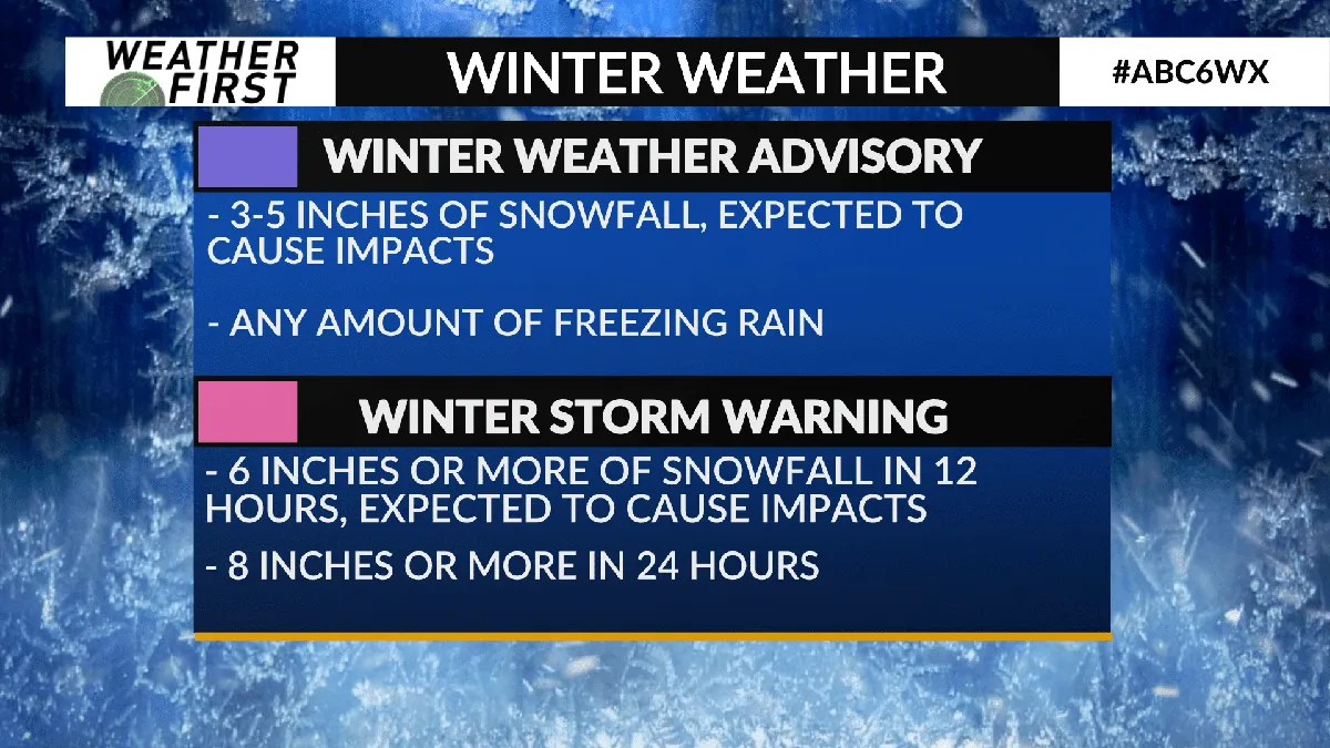
Authorities are closely monitoring the situation as it develops. The National Weather Service defines a winter storm watch as indicating a 50% chance of hazardous winter weather.
Residents are urged to stay updated on the latest weather reports and heed any warnings from local officials.